Position and routes of your fleet always under control
Precise position and routes
Know the status of your entire fleet in real time: position and routes, distance traveled, departure, arrival and idle times for each individual vehicle.
Complete control of the situation
See if your vehicles are stationary or moving; if their engines are on or off.
With you wherever you go
Monitor the situation from any internet-connected device: computer, tablet or smartphone.
Check routes
By clicking the icon of each vehicle you can immediately view the trip that it has just taken.

Improved efficiency
Calculate the times and distances between one of your vehicles and a specific destination, while monitoring up-to-the-minute traffic information, so that you can efficiently plan your entire fleet’s job assignments always taking a look at the position and routes.
Send drivers their job assignments
Directly notify operators of their destinations,position and routes, thanks to the onboard GPS Garmin navigation system that is connected to the MyWakes GPS device, thereby cutting down task planning times.
Google Street View
Thanks to the agreement with Google, not only can you access the maps on Google Maps over a secure HTTPS connection, but you can also access the satellite images and Google Street View.
In this way you can verify the actual position and routes of each vehicle, checking for idling in specific areas, such as warehouses, parking lots, historic city centers and restaurants or checking that the vehicles are not stopped near any no-entry areas, restricted traffic areas, gates or road obstacles.


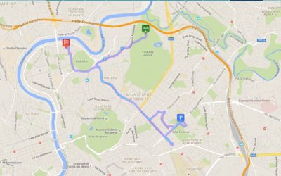
Analyze position and routes
MyWakes maps the trips that each of your vehicles has made.
You can monitor distance traveled, drive times, positions where vehicles were idle or stopped, average speeds and speeds at any point along the route.
You can view the graphs showing changes in speed and altitude over time.
Thanks to fuel level and temperature sensors, you can also view the graphs tracking the changes in these two factors.
Location history
MyWakes guarantees 12 months of data history.
Choose a track to see detailed information, including stats on speeds, altitudes, drive times; view the map or satellite image, as well as lots of other data.
You can extract position and routes information over a several day period and combine different tracks.
You can then export these routes onto GPX (GPS Exchange Format) files.

Events and actions
MyWakes provides dozens of different types of fully configurable alarms and events for the safety and security of your fleet.
You can be notified via SMS, email, phone call or by triggering an alert to a third party server via our webhooks.
Each activated alarm can provide details of the event that triggered it, such as exact time, address, vehicle licence plate, speed, etc.
Monitor situations such as the following:
- engine start-up with anti-theft system armed
- temperature in refrigerated truck is exceeded
- vehicle exits a 2D or 3D virtual boundary
- movement within an area
- vehicle is idle or stopped at POIs
- a set speed is exceeded
- position and routes
- movement with engine off (towing)
- departure from a set route
- movement of vehicle during off-hours
- excessive drop in fuel level
- engine lock/unlock
- and many more…

Odometer
Measure the distances that your vehicles have traveled in order to plan scheduled maintenance and improve fleet management, especially for long term hires.
Hour meter
For the management of heavy equipment, industrial vehicles and construction site machinery it is of upmost importance to supplement GPS data with information on running times, position and routes. MyWakes is also useful with vehicles that do not travel extensively but are still subject to wear and tear relating to hours of operation.
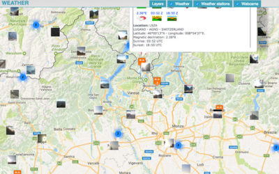
Weather forecast, conditions and cloudiness worlwide
The service displays the weather conditions and cloud cover levels around the world In the section "Utilities" you have the service to view the Weather conditions and cloud cover levels around the world on the map for quick consultation. The cloudiness will not...
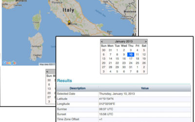
Sunrise and sunset times service worldwide
The service calculates the sunrise and sunset for the selected point and date. The service is available in the "Utilities" menu under the Sunrise / Sunset item. Select the location on Google Maps and the date on calendar. The system will automatically calculate...
The brand new GPS tracking platform is ready
The site offers services for the people, pets and objects location. The services are derived from the experience gained in the field of aviation. The tracking service allows to observe a path even in real-time. The path can remain private, to be shared with...