Avioportolano chart integration
MyWakes integrates Avioportolano flight charts and overlays the map with the tracks of your flights.
MyWakes increases flight tracking services thanks to the new connection between its GPS flight tracker system and the Avioportolano maps – reference for aeronautical cartography – which is now fully integrated into MyWakes.
You will get flight maps at Avioportolano digital chart site use them in your profile simply by entering the code that will be emailed to you when you purchase them.
This way you will be able to review your flights and plan your new flight plan using the Avioportolano charts as a base..
The purchased charts will be available in all MyWakes maps: both GPS tracker radar, track viewer and Rest Web API Iframe for developer will show users’ charts.
So, all third-party software that integrates MyWakes Rest interface will automatically inherit Avioportolano’s cartography support.
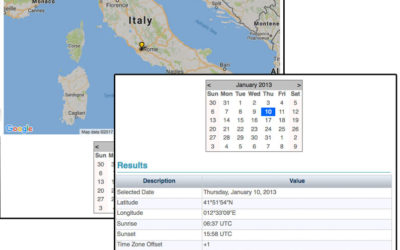
Sunrise and sunset times service worldwide
The service calculates the sunrise and sunset for the selected point and date. The service is available in the "Utilities" menu under the Sunrise / Sunset item. Select the location on Google Maps and the date on calendar. The system will automatically calculate...
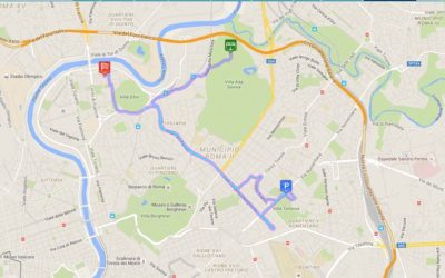
The brand new GPS tracking platform is ready
The site offers services for the people, pets and objects location. The services are derived from the experience gained in the field of aviation. The tracking service allows to observe a path even in real-time. The path can remain private, to be shared with...